Subscribe
48°

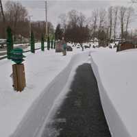
State Of Emergency Declared In NY As Heavy Snow Targets Hudson Valley, NYC, Long Island: Hochul
New York Gov. Kathy Hochul has declared a State of Emergency as a major winter storm threatens to bring heavy snowfall, dangerous travel conditions, and possible power outages across much of New York — including the Hudson Valley, New York City, and Long Island.
The emergency declaration, announced on Friday afternoon, Dec. 26, covers more than 40 counties, including Dutchess, Orange, Putnam, Rockland, Ulster, Columbia, Greene, Albany, Nassau, Suffolk, Rensselaer, Saratoga, and Westchester counties, as forecasters warned of four to eight inches of snow across the Mid-Hudson region and …
Here's Where The Wind Blew Hardest In The Hudson Valley Over Weekend
Powerful winds swept across the Hudson Valley on Sunday, Nov. 16, with several areas seeing gusts topping 40 to 50 mph, according to the National Weather Service.
The NWS released its highest wind reports early Monday morning, Nov. 17, showing widespread strong gusts across Orange, Putnam, Rockland, and Westchester counties.
Westchester Sees Highest Winds
The strongest recorded gust in the region hit 55 mph at White Plains Airport around 4:20 p.m. on Sunday, Nov. 16, making Westchester County the hardest-hit area in the region.
In addition to the 55 mph gust at the airport, a …
Freeze Warning Issued For Lower Hudson Valley, Long Island, NYC
Bundle up, New Yorkers — the first widespread freeze of the season is on the way.
The National Weather Service has issued a Freeze Warning for large portions of southeast New York, including New York City, Long Island, Westchester County, and parts of the Hudson Valley, effective from 1 a.m. to 9 a.m. on Tuesday, Nov. 11.
Forecasters say temperatures will fall to between 30 and 32 degrees, which could kill crops and other sensitive plants.
According to the NWS, the warning covers southern Westchester County, New York City, and Nassau and Suffolk counties.
Residents …
Utility Crews Preparing For High Wind Event In Hudson Valley, Long Island: Advisory Issued
Utility crews in the Hudson Valley are preparing for a blustery night ahead, as the National Weather Service issues a Wind Advisory warning of gusts up to 45 miles per hour overnight Wednesday, Nov. 5, through early Thursday, Nov. 6.
The advisory, in effect from 9 p.m. Wednesday to 8 a.m. on Thursday, covers Orange, Rockland, Putnam, and northern Westchester counties, along with parts of southern Connecticut and northern New Jersey. A separate advisory also covers Nassau and Suffolk counties.
Forecasters said sustained west winds of 15 to 25 mph could bring down tree limbs and c…
High Wind Watch Issued For Hudson Valley, NYC, Long Island: Gusts Up To 60 MPH Possible
The National Weather Service has issued a High Wind Watch for much of the Hudson Valley, New York City, and Long Island, warning of potentially damaging gusts into Thursday morning, Nov. 6.
According to the alert, issued just before 1 p.m. on Tuesday, Nov. 4, west winds of 20 to 30 mph are expected, with gusts possibly reaching 60 mph in some areas, including Orange, Putnam, Rockland, Suffolk, Nassau, and Westchester counties.
The NWS warns that the powerful winds could knock down trees and power lines, leading to widespread outages and hazardous travel conditions — especially f…
Here Are NY Rain Totals From Nor’easter That Drenched Hudson Valley, Long Island
The powerful Nor’easter that swept up the East Coast brought drenching downpours across New York, soaking parts of the Hudson Valley and Long Island with more than three inches of rain.
As of 10:30 a.m. Tuesday, Oct. 14, the highest total was 3.47 inches in Port Jefferson Station, Suffolk County. Heavy rain also fell across Westchester, Putnam, and Rockland counties, where several communities topped 2 inches, according to data released by the National Weather Service.
The slow-moving storm brought flooding, strong onshore winds, and coastal erosion before moving offshore Tuesday…
Scorching Heat, Bad Air Quality Grips Region: Alerts Issued For Westchester
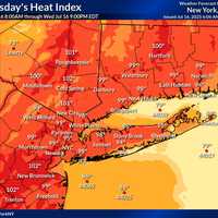
Residents across much of the Hudson Valley, Long Island, and New York City are under dual weather alerts on Wednesday, July 16, as officials warn of dangerous heat and elevated air pollution levels.
The National Weather Service has issued a Heat Advisory from 11 a.m. on Wednesday through 10 p.m. Thursday, July 18, warning that heat index values could soar to 100 degrees in parts of:
Rockland, Westchester, Orange, and Putnam counties;
New York City;
Northern and Southern Nassau County;
Suffolk County.
Forecasters say the dangerous mix of high heat and humidity could cause heat-related…
Air Quality Alert In Effect For Westchester: Here's When It Ends
If the air feels a little heavier today, you're not imagining it.
A health advisory for elevated air pollution levels remains in effect through 11 p.m. today, Wednesday, June 25, across much of the Hudson Valley, New York City, Long Island, and parts of the lower Hudson region.
The alert, issued by the New York State Department of Environmental Conservation, includes Westchester, Rockland, and all five boroughs, as well as Nassau and Suffolk counties. The concern: elevated levels of ground-level ozone, a pollutant that can make the air hazardous to breathe — especially for people with ast…
Westchester Faces Air Quality Alert As Temps Climb Into 90s Thursday
It’s not just hot — it’s hazardous.
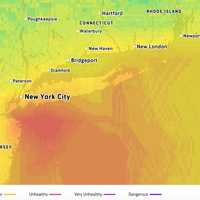
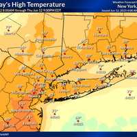
Air quality across New Jersey and New York is expected to be unhealthy for sensitive groups on Thursday, June 12, as temperatures climb into the 90s and Code Orange Alerts are in effect.
Health officials say that ground-level ozone and fine particulates will combine with heat to pose risks for children, seniors, and people with heart or lung conditions.
⚠️ Air Quality Alerts
Code Orange Air Quality Alerts issued by the NJ Department of Environmental Protection
Counties affected: Bergen, Essex, Union, Hudson, Passaic, Middlesex, Mercer, Ocean, Burling…