Forecasters Were Way Off: 13 Inches Of Snow Fell Unexpectedly In NJ, PA Towns Forecasters Were Way Off: 13 Inches Of Snow Fell Unexpectedly In NJ, PA Towns
Forecasters Were Way Off: 13 Inches Of Snow Fell Unexpectedly In NJ, PA Towns Four inches of snow at most was expected in the second snow storm of the week in New Jersey and Pennsylvania. But much more fell.  In the Friday, Feb. 16 and Saturday, Feb. 17 storm, up to 13 inches of snow fell in some towns across the region, according to the National Weather Service. Here's who got the most snow, according to the National Weather Service: ATLANTIC, NJ: Beuna Vista, 3.3 inches; Hammonton, 2.8 inches; Somers Point, 2.2 inches BERKS, PA: Lyons, 12 inches; Fleetwood, 9 inches; Blandon, 8.5 inches BERGEN, NJ: Westwood 3 inches; Fair Lawn 2.5 inches; River Vale 2 …
New Forecast Map: 4 Inches Of Snow Now Projected For Parts Of NJ, PA New Forecast Map: 4 Inches Of Snow Now Projected For Parts Of NJ, PA
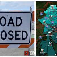
New Forecast Map: 4 Inches Of Snow Now Projected For Parts Of NJ, PA In a newly-released forecast map, parts of New Jersey and Pennsylvania are expected to get up to four inches of snow in this second winter storm of the week. The new map shows between 3 and 4 inches could fall along the Jersey Shore, in South Jersey, and in the Reading/Greater Philadelphia areas in the storm expected to begin late Friday, Feb. 16. UPDATE: 13 Inches Of Snow Fell In These NJ, PA Towns — See Who Got The Most Snow Central Jersey could see up to 3 inches while North Jersey and the Poconos will likely only see 1 or 2 inches, the NWS says. Snow will continue through Saturday, Fe…
Increased Snow Projections: 18 Inches Could Fall In Parts Of NJ, PA In Major Storm, NWS Says Increased Snow Projections: 18 Inches Could Fall In Parts Of NJ, PA In Major Storm, NWS Says
Increased Snow Projections: 18 Inches Could Fall In Parts Of NJ, PA In Major Storm, NWS Says The National Weather Service says parts of New Jersey and Pennsylvania could see more snow than what was initially predicted due to a shift in the storm track. In an updating briefing published Monday, Feb. 12, the NWS said 12 to 18 inches of snow could fall in parts of Sussex County, NJ and the Pocono Mountains. ALSO SEE: North Jersey School Closed, Delayed Ahead Of Major Winter Storm The weather map shows between 8 and 12 inches expected in parts of Bergen, Morris, Passaic, Essex, Warren, Somerset and Hunterdon counties, where winter storm warnings have been issued. Winter weather a…
New Weather Map Shows Snow Potential In Pre-Valentine's Day Storm Nearing Northeast New Weather Map Shows Snow Potential In Pre-Valentine's Day Storm Nearing Northeast
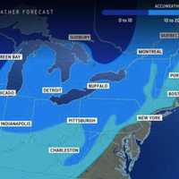
New Weather Map Shows Snow Potential In Pre-Valentine's Day Storm Nearing Northeast AccuWeather has released a new weather map ahead of a winter storm approaching the Northeast. The above model shows rain and/or snow taking aim at most of Pennsylvania, New Jersey, and northern Maryland early next week, likely sometime Monday, Feb. 12 into Tuesday, Feb. 13. "While the January thaw and break from the stormy pattern extended into early February, there is going to be a change in the pattern with a potentially impactful storm coming swinging across the Midwest and Northeastern states from Monday to Tuesday," AccuWeather Meteorologist Dean DeVore said. Precipitation is expected…
Snow Chance Lingers Into March Before May Tornado Risk, AccuWeather Spring Forecast Says Snow Chance Lingers Into March Before May Tornado Risk, AccuWeather Spring Forecast Says
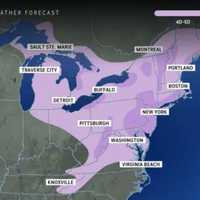
Snow Chance Lingers Into March Before May Tornado Risk, AccuWeather Spring Forecast Says Punxsutawney Phil predicted an early spring this year, but some meteorologists are saying otherwise. AccuWeather has released its Spring 2024 weather outlook, which calls for a "window of opportunity for snowstorms" along the East Coast through the first half of March. AccuWeather That includes plowable snow, so if you didn't get your fill this winter, there's still time, AccuWeather Veteran Meteorologist and Long-Range Forecaster Paul Pastelok says. "We may actually see a warmup in the second half of March across the eastern U.S.," Pastelok said, noting additional chances for snow acros…
Colder Air, Snow: Timing, Updates On New Winter Storm In NJ, PA Colder Air, Snow: Timing, Updates On New Winter Storm In NJ, PA
Colder Air, Snow: Timing, Updates On New Winter Storm In NJ, PA More seasonable weather is on the way this weekend, forecasters say. Following days of spring-like temps, colder air more suitable for January days, along with a wintry mix, is headed to New Jersey and Pennsylvania in the next two days, according to AccuWeather and the National Weather Service. Coastal low pressure will begin to bring mainly rain to the region tonight. Total rainfall is not expected to be all... Posted by US National Weather Service Philadelphia/Mount Holly on Saturday, January 27, 2024 "A pattern change featuring a return to colder air more typical of conditions f…
Chance Of Snow For NJ, PA In Sunday Soaker: Forecasters Chance Of Snow For NJ, PA In Sunday Soaker: Forecasters
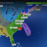
Chance Of Snow For NJ, PA In Sunday Soaker: Forecasters Temperatures are expected to surge near 60 by the end of the week, but come next, parts of New Jersey and Pennsylvania could be back in old man winter's grip, forecasters say. According to AccuWeather, a storm on Sunday, Jan. 29 will bring rain to major cities.  For northwest New Jersey, northern Pennsylvania and parts of Central Pennsylvania, however, a mix of rain and snow — or perhaps just snow — is expected. Thursday, Jan. 25 will be rainy and foggy with a high near 50 while Friday, Jan. 26 will be the same but slightly cooler, the NWS said. Saturday will be partly sunny with a hi…
Blowing Snow, Frigid Temps Make For Arctic-Like Weekend: Here's What's In Store For Next Week Blowing Snow, Frigid Temps Make For Arctic-Like Weekend: Here's What's In Store For Next Week
Blowing Snow, Frigid Temps Make For Arctic-Like Weekend: Here's What's In Store For Next Week Gusty winds and temps in the single digits will make for an arctic-like start to the weekend across New Jersey and parts of Pennsylvania. Saturday, Jan. 20 will be partly sunny with wind chill values between 10 and 15 degrees, and temps reaching a high of between 20 and 25 degrees, the National Weather Service says. Winds will make temps feel like they're in the single digits, and will keep snow blowing through the air until Sunday, Jan. 21, the NWS said. Sunday will reach highs of between 25 and 30 degrees, with winds up to 15 mph. Monday, Jan. 22 will be mostly sunny and slightly more m…
Snow Emergencies Declared Across PA Ahead Of Storm Snow Emergencies Declared Across PA Ahead Of Storm
Snow Emergencies Declared Across PA Ahead Of Storm Officials are advising residents across southeastern and central Pennsylvania to take caution ahead of the snowstorm predicted for Friday, Jan. 19, according to National Weather Service meteorologists.  Chester, Delaware, Philadelphia, and parts of lower Bucks and Montgomery counties are under a winter storm warning as of 5 p.m. Thursday. In Adams, Berks, Cumberland, Dauphin, Lancaster, Lebanon, Lehigh, Northampton, and upper Bucks and Montgomery counties, a winter weather advisory is in place.  NWS's Mount Holly, New Jersey station says snow will begin to fall around 4 to 7 a.m. …
New Forecast: Increased Snowfall Totals Expected, Arctic Temps To Follow Northeast Storm New Forecast: Increased Snowfall Totals Expected, Arctic Temps To Follow Northeast Storm
New Forecast: Increased Snowfall Totals Expected, Arctic Temps To Follow Northeast Storm Newly-released forecast maps show parts of the region could see up to six inches of snow in the end-of-week storm. Intermittent snow is expected to begin between 4 and 7 a.m. Friday, Jan. 19, with the heaviest amounts falling in the afternoon, the National Weather Service said. Snow will fall at about 0.5 inches per hour and will taper by the evening, with temps in the upper 20s and low 30s, the NWS said. SNOWFALL PREDICTIONS The areas expected to get 4 to 6 inches are Trenton, Long Branch, Allentown, and Philadelphia. Reading, Vineland, Parsippany and Toms River are expected to get 3 to …
Here's Who Got The Most Snow In Southeastern Pennsylvania Here's Who Got The Most Snow In Southeastern Pennsylvania
Here's Who Got The Most Snow In Southeastern Pennsylvania Greater Philadelphia woke up in a winter wonderland Tuesday, Jan. 16 as a wintry system worked its way up the eastern seaboard Monday night, Jan. 15, and into the early morning hours.  Though the snowfall has mostly tapered off, winter weather advisories remain in effect as of 3 p.m. Tuesday for Berks, Bucks, Chester, Delaware, Lehigh, Montgomery, Northampton, and Philadelphia counties, said the National Weather Service.  Here's how snowfall totals stacked up across the region in the last 24 hours, according to NWS meteorologists.  Berks County had its highest snowfal…
Six Inches Of Snow Could Slam Parts Of NJ, PA: Latest Forecast, Timing Updates Six Inches Of Snow Could Slam Parts Of NJ, PA: Latest Forecast, Timing Updates
Six Inches Of Snow Could Slam Parts Of NJ, PA: Latest Forecast, Timing Updates Newly-released forecast maps from the National Weather Service show up to six inches of snow could fall across eastern Pennsylvania and much of New Jersey. Accumulating snowfall will begin Monday, night Jan. 15, mainly after 7 p.m., and carry into Tuesday morning, Jan. 16, impacting the morning commute as it changes over to a wintry mix, the NWS said in its latest briefing. ALSO SEE: North Jersey School Delays For Tuesday, Jan. 16 Between 4 and 6 inches of snow was being forecast for most of North Jersey (including Morris, Sussex, pars of Bergen/Essex/Hudson, Warren, and Hunterdon Counties…